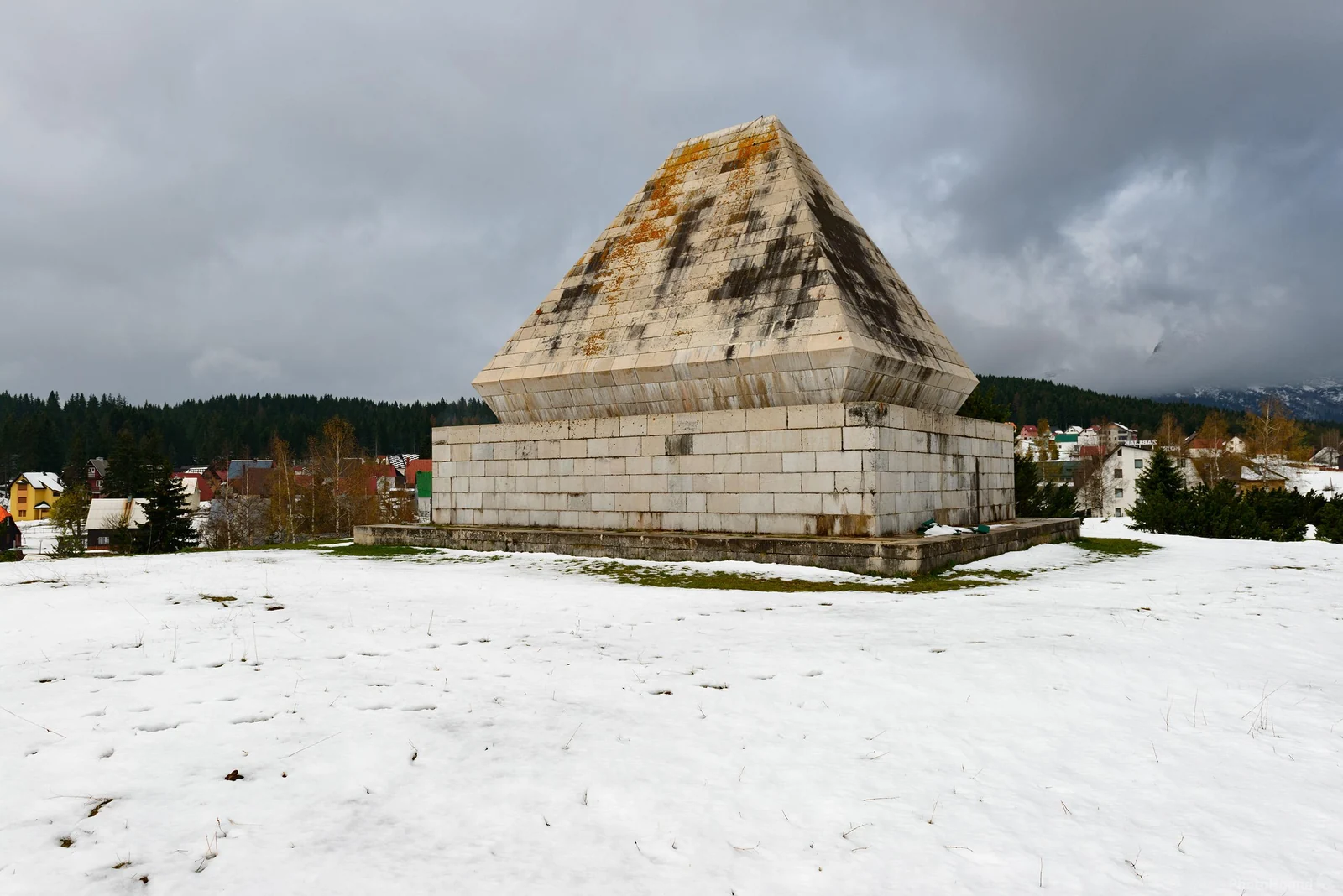
A white stone pyramid rises above the houses of Zabljak, its shape modeled on a mountain house. The memorial honors people from the Durmitor area who died in the war, and you can see it on a walk through town.
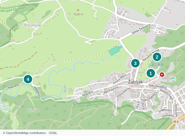
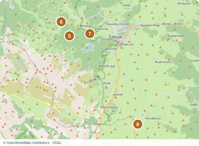
Four places are in Zabljak or at its edge in Pitomine. Four lakes lie farther out. The markers show the sites and lakes, not parking areas or the start of every trail.
Beyond the town, the way you visit each place changes. Some are reached on foot along a trail, while the route to others crosses an open plateau. Around Zabljak, two places can look close on a map yet call for very different outings.
01
Memorial to Fallen Fighters
Memorial to Fallen Fighters
A large pyramid of pale stone blocks stands above the houses of Zabljak. Steep sides rise from its broad base and meet at a point, like the roof of a mountain house. From the rise, you can see the town's roofs and a darker band of forest behind them.
Branko Bon built the memorial in 1963 in memory of fallen fighters and victims of fascist terror from the Durmitor area. Its rooflike silhouette echoes the mountain houses of the Durmitor area.
The pedestrian approach to the complex begins at the junction of Vuk Karadzic Street and Jakov Ostojic Street. The map point marks the memorial, not a parking area. Memorial to Fallen Fighters on Google Maps
02
Church of the Holy Transfiguration
Church of the Holy Transfiguration
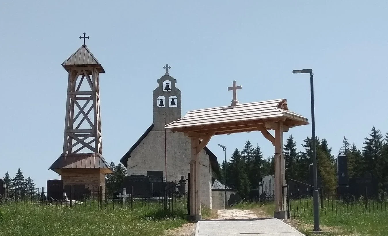
The Church of the Holy Transfiguration has a pale stone facade and three bells in its gable. A separate wooden bell tower stands beside it, and part of the enclosed church grounds is visible through the wooden gate.
According to the municipality's account of local history, the church survived the wartime destruction of Zabljak. Local memory also connects it with a victory in 1862. The surviving stone church now stands among buildings that went up around it after the war.
The church remains a place of worship, and regular hours for tourist entry have not been confirmed. You can view it from outside on a town walk while respecting services and the area around the graves. For an interior visit, make a separate arrangement or first obtain reliable, up-to-date information that it is open. Church of the Holy Transfiguration on Google Maps
03
Varezina Voda Well
Varezina Voda Well
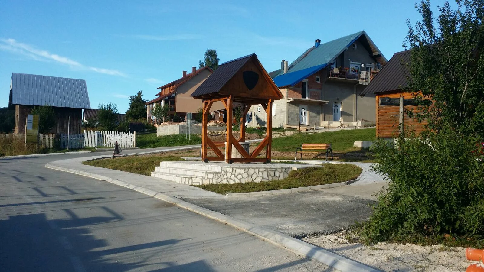
At a fork in Zabljak's streets, the restored Varezina Voda well has a stone base and wooden roof. A path runs past it, with a bench beside it and houses beyond. Its position shows how a public water source once stood along the town's everyday routes.
The name Varezina Voda lives on in local stories about the beginnings of Zabljak, though there is more than one explanation for the town's name. The municipality restored the existing well in 2020, and the tourist organization now lists it among the town's cultural sites.
You can see the well from the public road and path. Its water has not been confirmed as safe to drink, so do not use it to refill a bottle. Varezina Voda Well on Google Maps
04
Durmitor National Park Natural History Collection
Durmitor National Park Natural History Collection
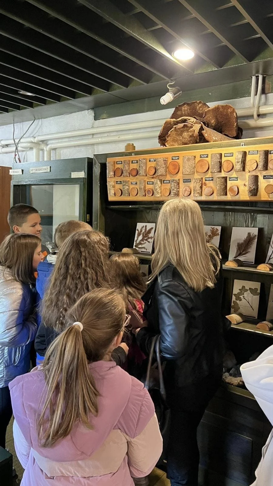
At the western edge of Zabljak in Pitomine, the national park's administrative building houses a natural history collection. Tree cross-sections, plant samples and animal specimens are kept behind glass. The cut wood reveals growth rings, while the samples let you see leaf shapes and animal forms much closer than you usually can in the forest.
At one workshop about Durmitor wildlife, pupils watched footage from camera traps and heard how the park tracks a bear named Aleksandar. The same building has also hosted an exhibition of local crafts. It displayed wooden vessels, gusle instruments, rugs and wool clothing made by local communities.
Arrange a visit to the collection with the park administration first. Occasional workshops and exhibitions do not mean that a permanent display is open every day. An earlier accessibility review reported stairs and no lift to the upper floor. If step-free access matters to you, check the current conditions directly with the park. Durmitor National Park Natural History Collection on Google Maps
05
Zminje Lake
Zminje Lake
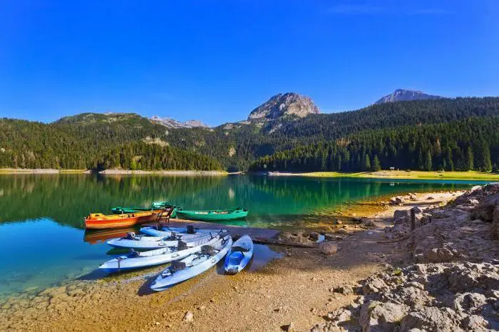
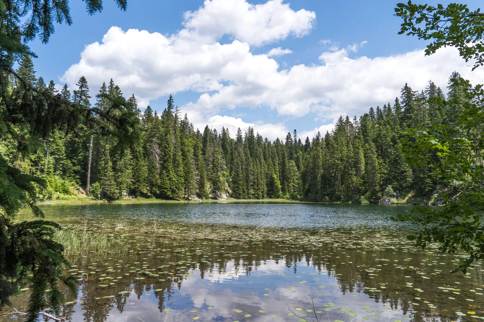
Zminje Lake appears among conifers, in a hollow almost enclosed by forest. The trees grow close to the water, so the view is more enclosed than at Black Lake.
The lake's name has been linked to branches of the surrounding trees that resemble snakes. Spruce shadows make snakeskin-like patterns on the water. Mlinski Potok flows out of the lake and reaches the larger part of Black Lake after about 2.6 kilometers, about a hundred meters lower down.
A marked walking trail leads to Zminje Lake from the direction of Black Lake. The map point marks the water, not parking or a trailhead. Check the trail's condition with the national park before setting out, especially outside the main walking season. Zminje Lake on Google Maps
06
Jablan Lake
Jablan Lake
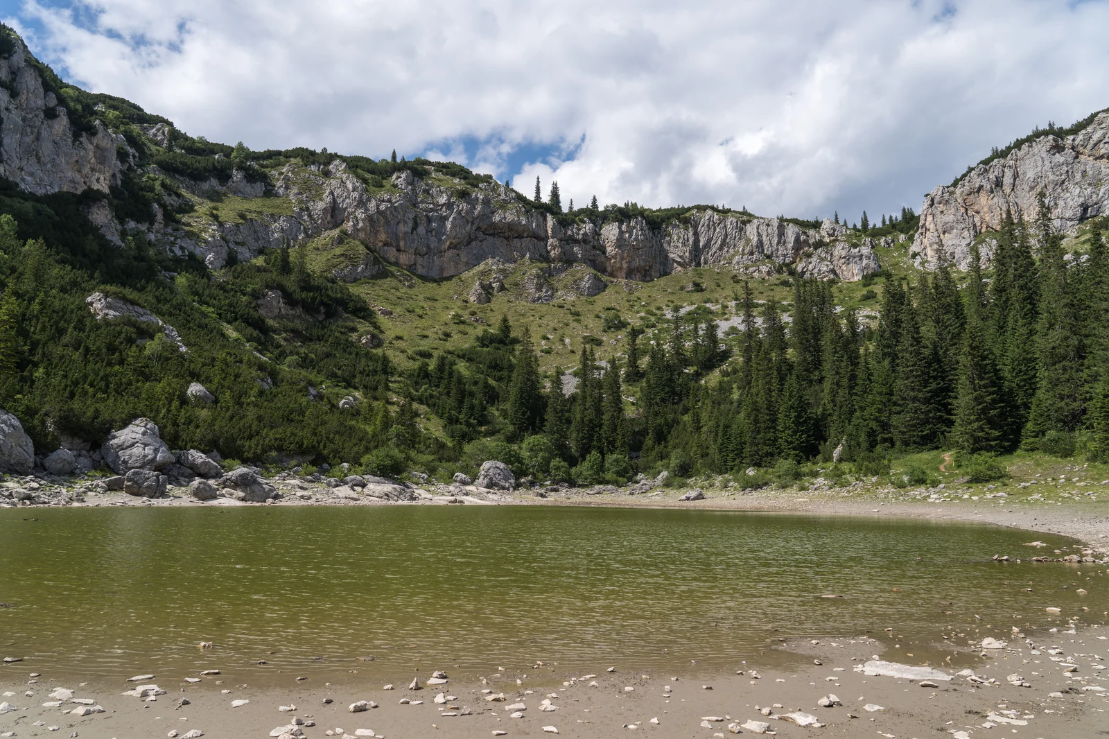
Jablan Lake lies below the high rocks of Crvena Greda at about 1,791 meters. Conifers line one part of the shore, while rocky slopes enclose another. The space around the water is wider and rockier than at forested Zminje Lake, a difference you see as you come out of the trees.
A walking route runs from Momcilov Grad to Jablan Lake through pine forest. You first walk among the trees, then gain a view of the water below the rocky ridge. This is a hike in its own right, not a brief roadside stop beside the lake.
Plan to follow the marked trail to Jablan. Do not assume it is passable all year or suitable for very young children. Check ground conditions with the park or tourist organization before setting out. Jablan Lake on Google Maps
07
Barno Lake
Barno Lake
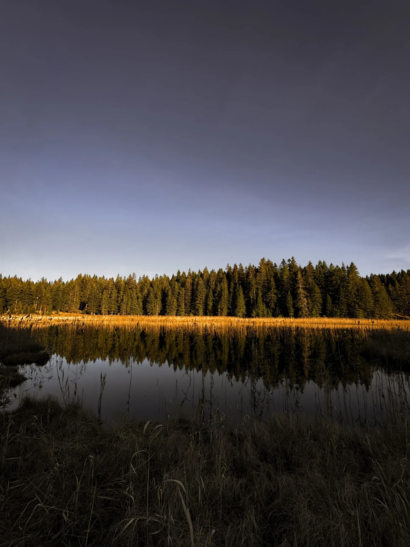
Barno Lake is shallow and surrounded by reeds, sedges and conifers. Vegetation is visible on the water in places, so the line between shore and lake is not always sharp. That marshy edge gives it a different appearance from Durmitor's more open lakes.
The lake and its immediate surroundings lie in the strictest protection zone of Durmitor National Park. A visit therefore does not involve pushing into the reeds or reaching every part of the shore. View the vegetation from the trail and leave the ground around it undisturbed.
The park lists a marked walking route connecting Barno, Zminje and Black Lake. Keep to that route and the park's instructions. Swimming, fishing and walking through the reed beds are not part of this visit. Check the trail's condition before setting out, as a line on a map cannot tell you what the ground is like that day. Barno Lake on Google Maps
08
Vrazje Lake
Vrazje Lake
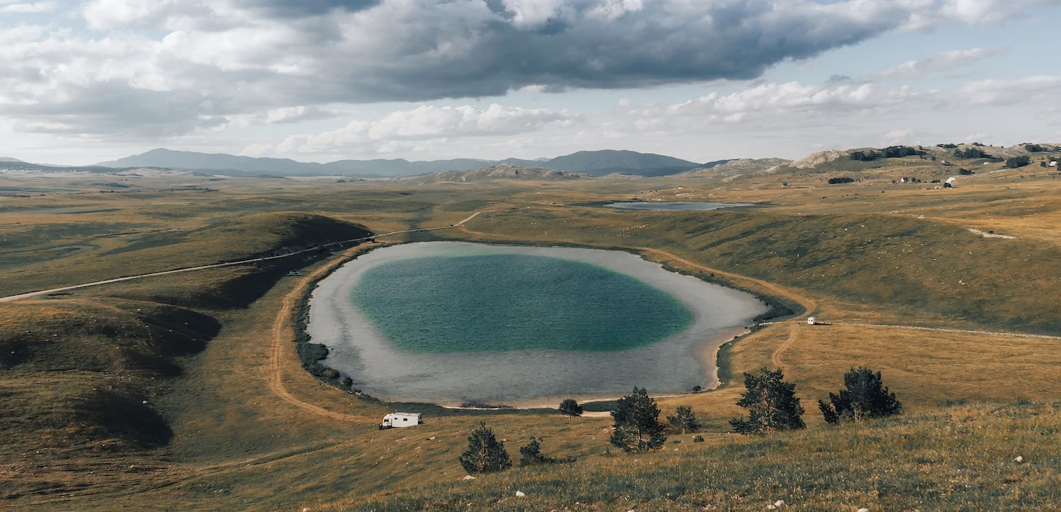
Vrazje Lake lies on the open Jezerska Povrs plateau. The nearly round lake is surrounded by grass, without the forest belt or high rocks that frame other lakes near Zabljak. When you reach this part of the plateau, you see the lake beneath a wide sky and alongside a long stretch of pasture.
According to one local legend, a devil and a she-devil built a castle of ice crystals in the lake. The story explains its name. The lake is of glacial origin, with a maximum depth of about 11 meters.
You reach Vrazje Lake across Jezerska Povrs, but parking beside the water and public access to every part of its shore have not been confirmed. Check the road and ground conditions before leaving, and plan your visit around a view of the lake and plateau. Vrazje Lake on Google Maps
Choosing a visitTown sights or a lake outing
TownOutdoor town sights or the collection
You can see the memorial, church and well from outside in Zabljak. The natural history collection is at the edge of town in Pitomine and requires an arrangement with the park in advance. Without an appointment, you can still see the three outdoor town sites.
LandscapeForest, rocky slopes or open plateau
Zminje and Barno are forest lakes, Jablan lies below the high rocks of Crvena Greda, and Vrazje sits on the open Jezerska Povrs plateau.
Different places
Similar lake names and two park centers
Lakes
Zminje and Zminicko are different lakes
Zminje is a forest lake below Crvena Greda. Zminicko is a separate lake toward Njegovudja and Sinjajevina. Check the full name on your map before following the marked trail to Zminje.
Collection
Two national park visitor centers
The collection is in the park's working administrative building at the edge of Zabljak. The park marks another building beside the educational trail near Black Lake as non-operational in its plan. A listing labeled "visitor center" therefore does not mean both buildings have an open exhibition.
Further details
Exhibits and a cycling route
Collection
If geology interests you
The natural history collection also includes geological samples. When arranging a visit, ask whether they are currently on display.
Plateau
If you cycle across Jezerska Povrs
The park lists a cycling route across the plateau among its activities. You can combine that outing with a view of Vrazje Lake, but the published route does not establish that every point along its shore can be reached by bicycle.
Questions about hidden places around Zabljak
Which of these places make sense to visit with children?
With very young children, do not assume that any lake trail will be easy or suitable for a stroller. The memorial, church and well allow for a shorter outdoor visit in town. The collection is an option only if you arrange it with the park and check the stair access. If you want to visit a lake, ask Durmitor National Park about the current condition and length of the specific trail before adding it to a family day out.
Can I visit some of these places without a car?
The memorial, church and Varezina Voda are in Zabljak. The collection is at the western edge of town in Pitomine and requires an arrangement in advance. If you are already going to Black Lake, a marked walking trail leads from there to Zminje. The route to Jablan starts at Momcilov Grad, but transport to that trailhead remains unverified. For the more distant Vrazje Lake, there is no confirmed regular bus service or verified drop-off point near the shore.
Can I plan the lake trails outside the main summer season?
The month alone does not tell you whether a marked trail is passable on the day you visit. Rain, snow and ground conditions may change your plan, especially for Jablan at about 1,791 meters. Check current conditions with Durmitor National Park before setting out. If a trail is unsuitable, you can switch to the outdoor town sites. The collection still requires a separate appointment.
A car for outings beyond ZabljakCompare rentals and pickup terms if you are planning a separate trip to Jezerska Povrs. Check the road and parking near the lake separately.