
Durmitor Ring drive from Žabljak
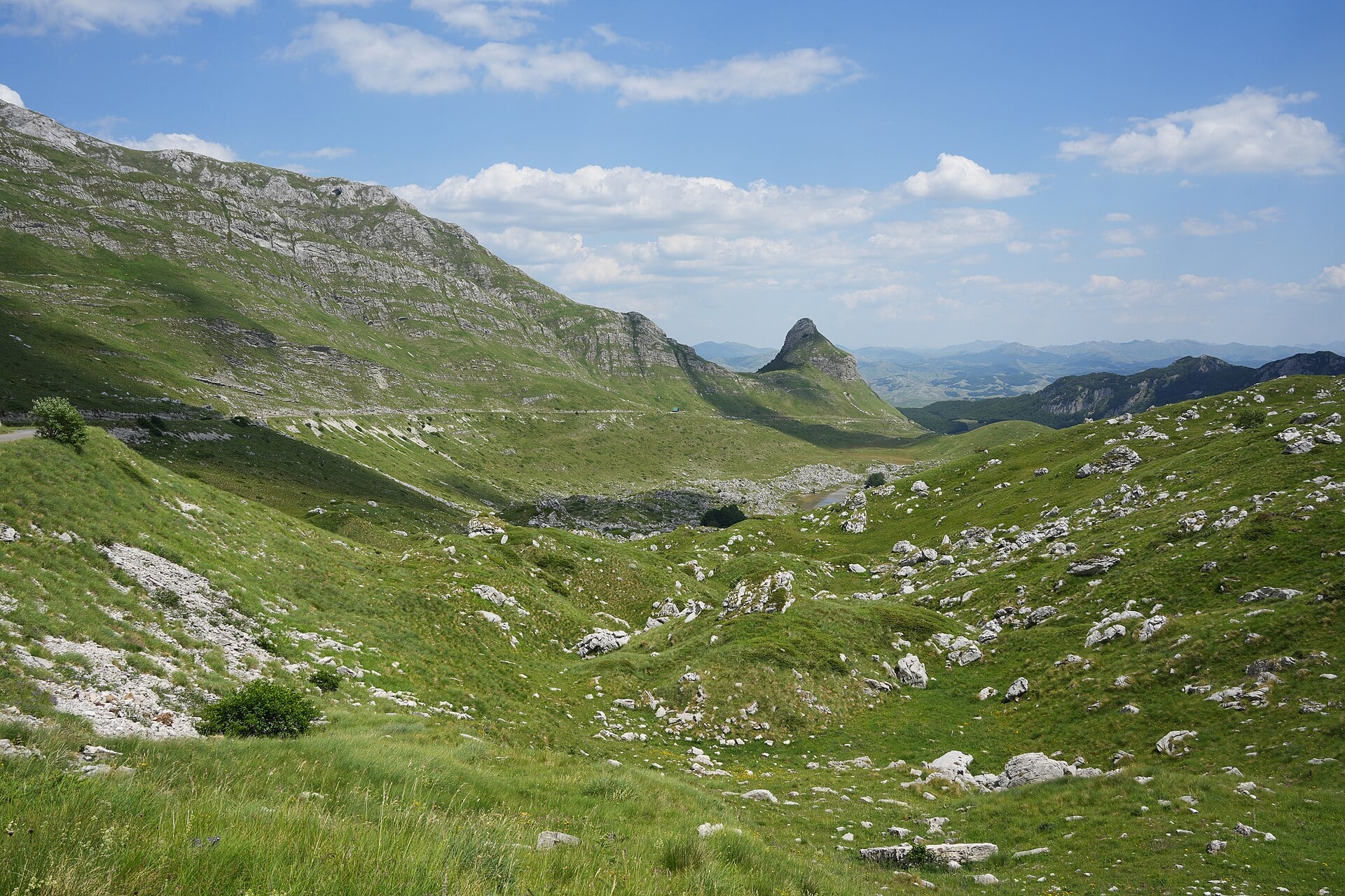
The Durmitor Ring is an official scenic road linking Sušica Canyon with Durmitor’s high passes. Beyond the steep wooded slopes, the road emerges among pastures and the rocky landscapes of Prutaš and Sedlo, so the scenery changes considerably within a single circuit. Starting from Žabljak lets you add the walk up to Ćurevac and a final walk around Black Lake.
Trip overview
- Trip duration
- 11-13 hours
- Number of stops
- 8
- Route distance
- Approx. 95 km
Why set aside a day for this trip
The Durmitor Ring suits travellers who want to experience high mountain scenery without a long summit hike. The car takes you below folded rock faces and down to the floor of a wooded canyon, while walks open up views that are not available from the road. From Žabljak, the first trail is a short morning drive away, leaving the rest of the day to explore the range and its viewpoints.
Trip and costs at a glance
| Trip duration | 11-13 hours |
|---|---|
| Transport | A car is needed · car hire offers |
| Sights on this trip | |
| Fuel consumption | Estimated 10-12 L |
| Tolls | No charge |
| Admission costs | Durmitor National Park €5 and Piva Nature Park €1 per adult |
| Navigation |
Map and navigation

Route, visits and breaks
The timings include the walk to Ćurevac and back, the full Black Lake visit including the walk to and from the lake, shorter stops, lunch and a 45-minute allowance for delays. Choose this full plan for longer summer days, with both high sections of the ring confirmed open.
01Morning departure and the walk to Ćurevac
20 min driving · 5 min parking · 1 h 15 min walking and return
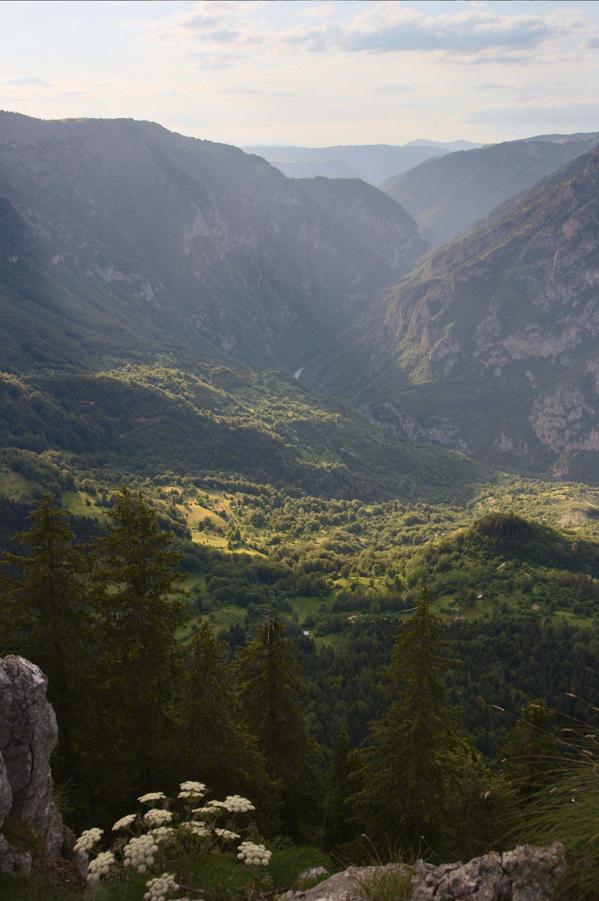
Leave Žabljak in the morning and open the prepared route to the Ćurevac car park. The directions lead to the start of the walking trail, while the summit itself is not set as a driving destination.
The viewpoint is approximately a kilometre’s walk from the car park in one direction. Allow an hour and 15 minutes for the ascent, the canyon view and the return to your car. The path is rocky and narrow in places, beside steep slopes, and slippery rock after rain significantly changes the walking conditions.
There is a Durmitor National Park ticket checkpoint on this approach. The adult day ticket costs €5 and also covers the later visit to Black Lake. Keep it for the whole day.
02Via Štuoc and Mala Crna Gora to Sušica Lake
1 h driving · 35 min parking, approach and visit
From Ćurevac, retrace the prepared approach via Nadgora and continue along the high road below Štuoc, then through Mala Crna Gora towards the Sušica Valley.
This is the most demanding part of the drive: a narrow road descends the canyon side with sharp bends and passing places. Rockfalls are possible after heavy rain. Before setting off, check that both high sides of the ring, via Štuoc and Sedlo, are open in the AMSCG road report and with Durmitor National Park.
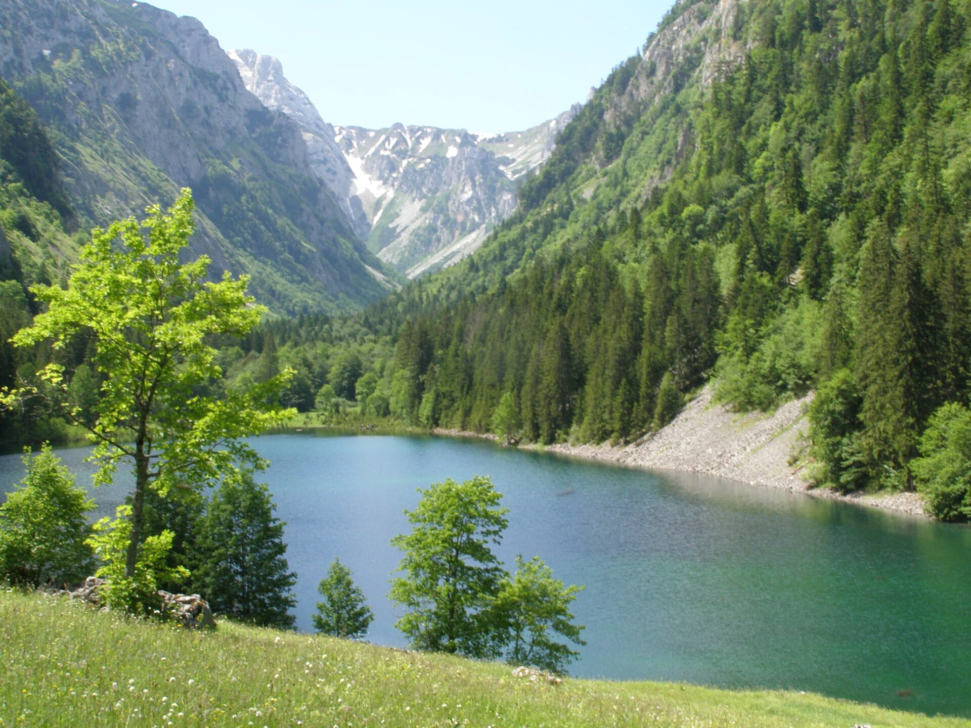
Leave the car in the small car park beside the road at the Sušica ticket checkpoint. Allow about 35 minutes for parking, the short approach into the lake valley, looking around and returning. The lake often dries out in summer, when a grassy valley floor replaces the shoreline.
03A stop at Nedajno viewpoint
15 min driving · 25 min parking and view
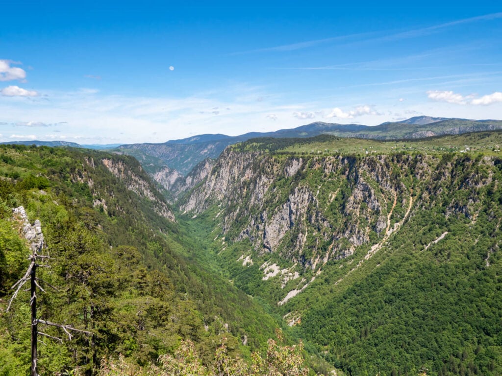
The road climbs in hairpin bends from the Sušica Valley up to the Pivska planina uplands. A widening beside the viewpoint lets you get out of the car, with about five minutes allowed for parking.
Set aside another twenty minutes or so for the view down the canyon. After being on the valley floor, you can now see its width and the height of the rock faces opposite. Continue from here towards Trsa through the wooded Milogora area.
This part of the circuit enters Piva Nature Park. The published entry fee is €1 per adult, separate from the Durmitor ticket.
04Lunch in Trsa, halfway through the trip
20 min driving · 1 h 5 min parking and lunch
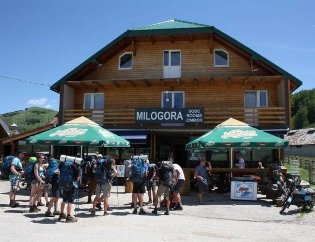
The Milogora restaurant, right beside the road through the village, is a practical lunch stop.
Milogora serves local cuisine, and steamed lamb is among the specialities highlighted by Piva Nature Park. Trsa stands on an open plateau, so this break comes before the climb resumes towards the upland valleys. Check the hot-food selection and whether the restaurant is open on your arrival date, especially outside the summer season.
05The viewpoint below Prutaš
30 min driving · 30 min parking and viewpoint
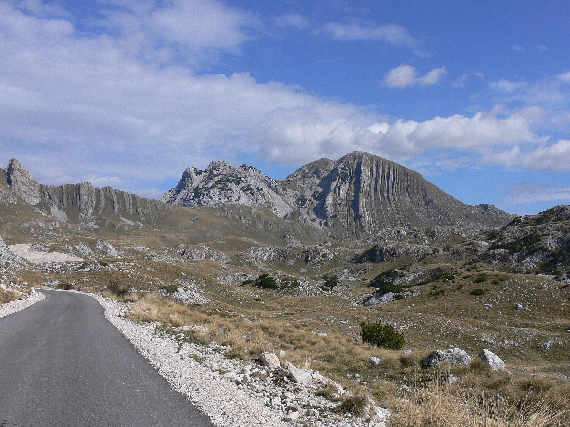
From Trsa, continue via Pišče towards Durmitor’s upland valleys. Leave the car in the widening beside the viewpoint, with about five minutes allowed for parking.
Allow about 25 minutes to look at Prutaš’s rock layers and the surrounding valleys. The hike to the summit of Prutaš is not included in this driving itinerary.
06Time at Sedlo pass
20 min driving · 40 min parking and pass visit
Allow about 20 minutes to drive from the viewpoint below Prutaš to Sedlo through the upland valleys. There is parking at the pass beside the start of the hiking trails. About five minutes are allowed for parking.
Spend another 35 minutes or so at the pass: look at Sedlena greda and the open valleys on both sides of the road, walk around the immediate viewpoint area and return to the car. Trails towards Bobotov kuk lead from here into high mountain terrain, while this visit stays within the pass area.
07A brief stop above Pošćenska Valley
10 min driving · 20 min parking and view
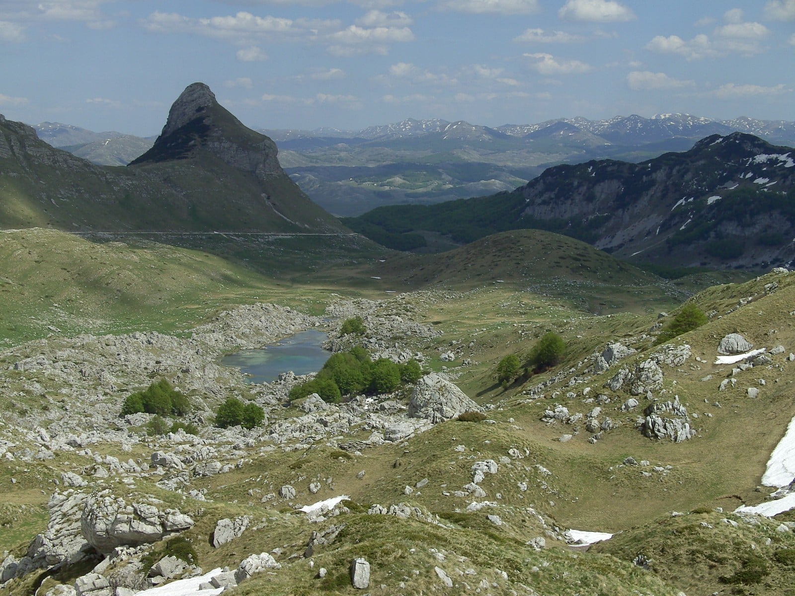
Descend from Sedlo towards Pošćenska Valley. A brief stop is planned at a roadside widening, with about five minutes for parking and another 15 minutes for the view.
From here you can look across the valley and towards the summit of Stožina. You view the lakes from the roadside. The Jezero walking circuit, about 6.2 kilometres long, is a separate walk of roughly three hours and is not included in this stop.
08A final walk around Black Lake
25 min driving · 2 h 30 min parking, approaches and full lake circuit
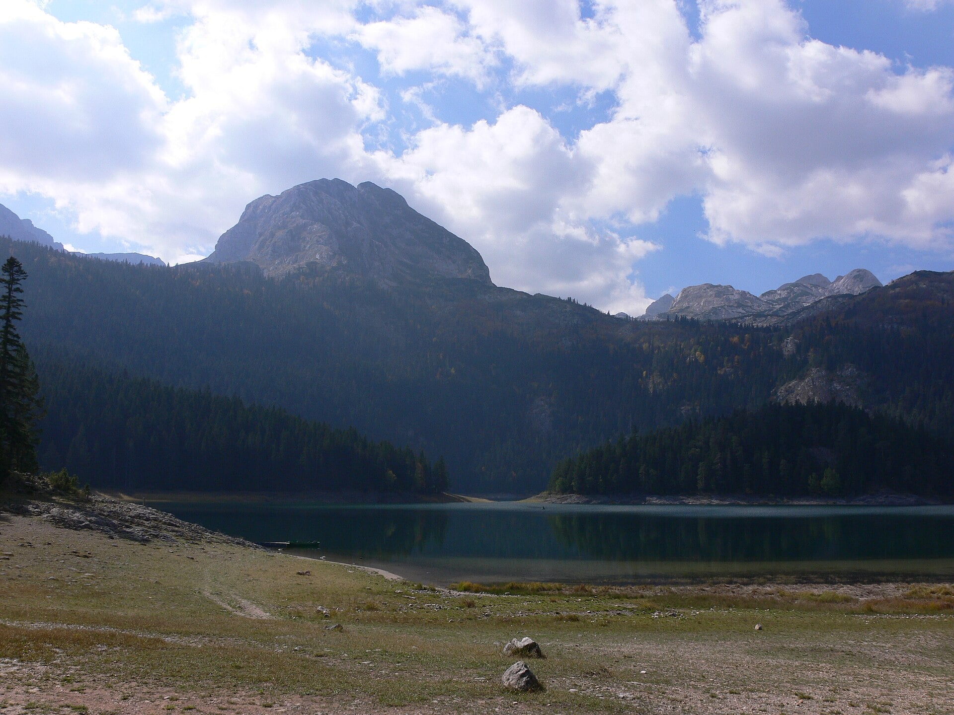
Continue from the viewpoint towards Žabljak, then to the car park on the approach to Black Lake. The prepared driving destination ends at the car park, before the walk to the shore.
Allow two and a half hours for the entire visit. This includes parking, approximately 600 metres on foot from the barrier to the lake, a shore circuit of about 3.5 kilometres, time for the view of Međed and the return to your car. Check the condition of the whole shoreline path when you arrive, as water levels and damage to the trail can affect access.
The Durmitor day ticket you have already bought also covers this visit. Parking is charged separately: the published price from June through the end of September is €3 per hour or part of an hour. Budget for three chargeable hours for this visit, or about €9 per vehicle, according to the published price list.
09Return to Žabljak
10 min driving
It is about another ten minutes’ drive from the Black Lake car park to central Žabljak.
Plan on about 11-13 hours for the whole trip. This schedule suits the longer summer days, when the final lake visit can still take place in daylight.
Trip highlights
01Ćurevac and the view into Tara Canyon
Ćurevac is a viewpoint on the northern side of Durmitor, at approximately 1,625 metres above sea level. From its rocky edge, the view follows Tara Canyon and the settlement of Tepca deep below the steep slopes. The open panorama shows the canyon’s scale much more fully than brief views from the road.
The canyon is part of the Durmitor area listed as a UNESCO World Heritage Site. The river has cut a deep valley through the limestone range, and the contrast between the upper rocks, wooded slopes and inhabited terraces is visible from the same spot. Tepca gives the scene a human scale, with houses and cultivated plots set within the canyon’s vast space.
02Sušica Lake and its changing valley
Sušica Lake lies in a widening on the floor of Sušica Canyon. When there is enough water in the valley, the lake appears beneath the steep wooded slopes. It is fed by the Durmitor catchment, and whether it holds water through the year depends on inflow from the Sušica and rainfall.
During dry summer months, the water can disappear completely. Grass and other plants then grow on the lake bed, so the same place is visited as a green valley.
Being on the valley floor reveals how closely the canyon sides enclose this space. As the road continues towards Nedajno, the same landscape opens up again, this time from the upper edge of the canyon.
03Nedajno on the edge of Sušica Canyon
Nedajno is a village in the Pivska planina uplands, directly beside the steep side of Sušica Canyon. At the developed viewpoint, the land opens abruptly towards the deep valley, while a plateau with village houses and pastures continues behind it.
On the opposite wooded canyon slope, you can see the narrow winding road used for the earlier descent into the valley.
04Prutaš and its tilted rock layers
Prutaš, 2,393 metres high, stands out among Durmitor’s summits for its long, almost vertical rock layers. Seen from the scenic road, they resemble parallel rods, with grassy slopes descending between the rocky sections.
Sedimentary layers were folded and uplifted by tectonic movements, and erosion exposed them further. As a result, individual layers on this side of the range can be distinguished even from the base.
05Sedlo and the surrounding upland valleys
Sedlo is a road pass at approximately 1,907 metres above sea level. The road across it links the western side of the range with the valleys towards the Jezerska visoravan plateau. The rocky Sedlena greda rises immediately beside the pass, above the grassy slopes crossed by the road.
The pass is a well-known starting point for hiking trails, but its viewpoint also makes a worthwhile stop for people travelling by car. From beside the road, you can see the transitions between open grass, scree and high rocky ridges.
Sedlo is one of the best-known parts of the ring, but it is not its highest road point. The northern crossing below Štuoc reaches approximately 1,952 metres.
06Pošćenska Valley, Stožina and the small lakes
Pošćenska Valley opens out below the eastern side of Sedlo. The pointed summit of Stožina stands above grassy depressions and lakes, making it one of the most easily recognised landmarks on this part of the road.
Valovito, Modro and other small lakes of the Durmitor area lie in the valley. Their arrangement follows depressions in terrain shaped by glaciers. From the viewpoint, you can see the lake basins, grassy ground and rocky valley edges together. This gives a different view of Durmitor’s lakes from the one you get later in the woods beside Black Lake.
07Black Lake below Međed
Black Lake is Durmitor National Park’s largest lake and one of its most recognisable sights. Međed rises above the wooded shore, its dark outline reflected in the water. The dense conifer forest and its shade contribute to the dark colour that gave the lake its name.
The lake is made up of Veliko jezero (Big Lake) and Malo jezero (Small Lake), joined by a natural channel. When the water level falls in summer, the connection between them may temporarily disappear.
The shoreline path runs between the water and the woods, with changing views of Međed and the opposite bank. The intermittent Čelina waterfall may also flow with the spring inflow. After the rocky passes and open pastures of the ring, finishing beside the lake shows Durmitor’s wooded side at close range.
Questions before driving the Durmitor Ring
Do you need a 4x4 for the Durmitor Ring?
The main scenic route is paved and does not require a 4x4 when the road is open and free of damage that restricts access. A smaller car makes passing on narrow sections easier. For a driver who is uncomfortable beside a steep slope, a larger SUV will not remove that difficulty, so a locally arranged trip with a driver is a more sensible choice.
Is the road one-way, and which direction should you take?
The ring is not one-way. For a passenger car, the official map recommends travelling anticlockwise: the northern side and Sušica first, then Trsa and Sedlo. On narrow sections, both directions share the same road, with passing at widenings.
Can you drive the whole ring in winter?
The high sections of the ring are generally closed by snow in winter. An open approach to Black Lake or one village does not establish that the entire circuit is open. Both linked crossings, via Štuoc and Sedlo, are needed, along with enough daylight for all the visits.
More day trips from Žabljak
Biogradska Gora by car from Žabljak through the Tara Canyon
The full circuit of Biogradsko Lake and Bjelasica’s old-growth forest, with Đurđevića Tara Bridge, Dobrilovina and lunch beside the Tara. A day trip by car from Žabljak.Black Lake, Savin Kuk and the lakes of the Jezerska Plateau from Žabljak
A drive to Vražje and Riblje lakes, two stecci burial grounds and Savin Kuk, followed by a longer walk around Black Lake.Drive from Žabljak to Pošćenje, Komarnica and the Nevidio Canyon entrance
Two village lakes, a valley walk and the approach to a narrow canyon. A day trip from Žabljak with lunch in Pošćenje and a return on paved roads.Piva Lake, Plužine and Piva Monastery from Žabljak
Views over Piva Lake, a lakeside walk in Plužine and a visit to the relocated Piva Monastery. A seasonal day trip via Sedlo and Trsa, with lunch and a return drive via Šavnik.Đurđevića Tara Bridge, Dobrilovina and Zminičko Lake from Žabljak
An out-and-back walk beside Zminičko Lake, Dobrilovina Monastery and a view of the bridge over the Tara on the return journey. A full day from Žabljak with lunch at Ravnjak and ready-to-use driving directions.Open the guides to arrival, parking, accommodation, safe travel and places worth visiting in Žabljak and Durmitor.
Guides for trips and stays in other cities
Podgorica
Open city guide
Kotor
Open city guide
Cetinje
Open city guide
Tivat
Open city guide
Herceg Novi
Open city guide
Igalo
Open city guide
Budva
Open city guide
Petrovac
Open city guide
Bar
Open city guide
Ulcinj
Open city guideDrives and day trips from other places
If Žabljak is part of a longer trip to the coast, another mountain town or an airport, use the Montenegro guide to plan the rest of the journey.
