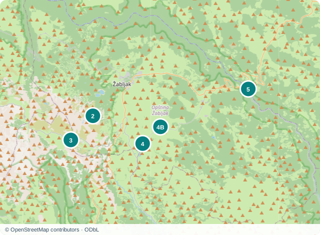
01Near town, outside the centre
Black Lake
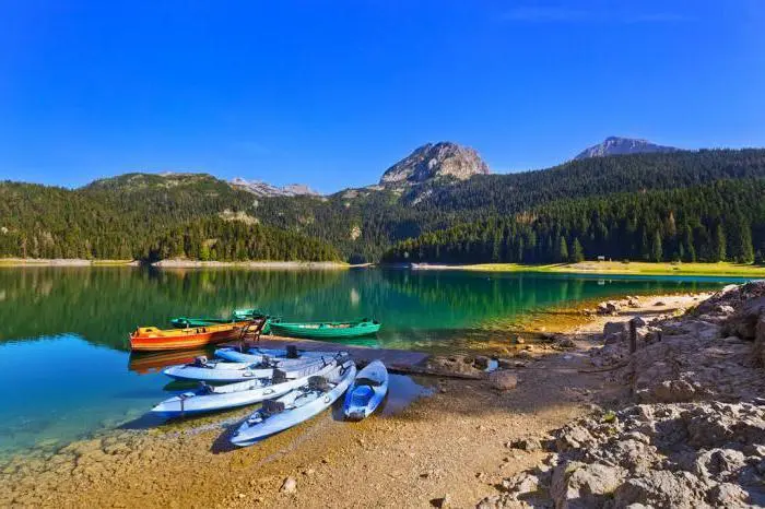
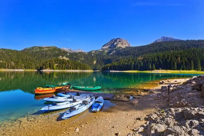
Black Lake lies beneath Medjed, beside a conifer forest that reaches almost to the water. From the rocky shore, you can see the belt of forest with the mountain's rocky sides above it. Their reflection may appear in the water, continuing the view of Medjed on the lake's surface.
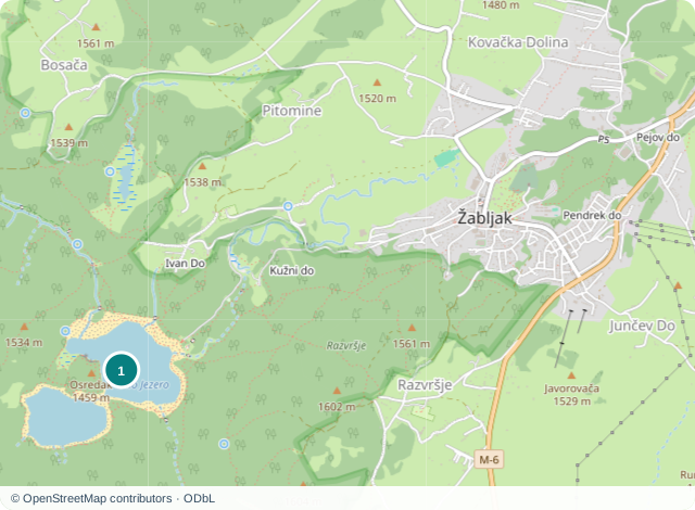
The lake consists of Veliko and Malo lakes, joined by a narrow natural channel. In summer, when the water level falls, this connection can dry up and the two bodies of water become separate. Changing water levels mean that the same stretch of shore does not look the same throughout the year. The lake belongs to Durmitor National Park, outside central Zabljak.
Visiting: Durmitor National Park's published price list gives a daily admission charge of 5 € per person, including the Visitor Centre and educational trails. Parking and additional activities have separate conditions. For the day of your visit, check the price and the condition of the stretch of shore you want to see.
Durmitor National Park price list02Across the wider Durmitor area
Savin Kuk
Savin Kuk offers a panorama of Durmitor's peaks and lakes. Black, Poscensko, Vrazje and Riblje lakes appear as separate bodies of water among the slopes, making their layout easier to understand than when you are standing on a single shore.
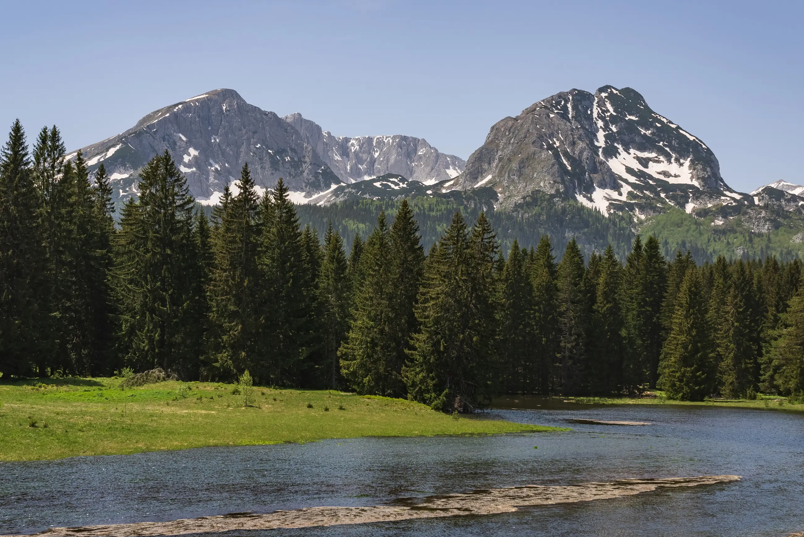
Savin Kuk can also be viewed from below, across the water and a belt of conifer forest. From there, the mountain's rocky sides are in the foreground. Looking towards the summit and seeing the panorama from it are different choices: one shows the mountain itself, while the other reveals the landscapes around it.
Visiting: If you are relying on the panoramic chairlift, confirm which sections are operating, the price and whether a return journey is possible. The description of the summer ride does not confirm these conditions for every season or date.
TC DurmitorSedlo Pass
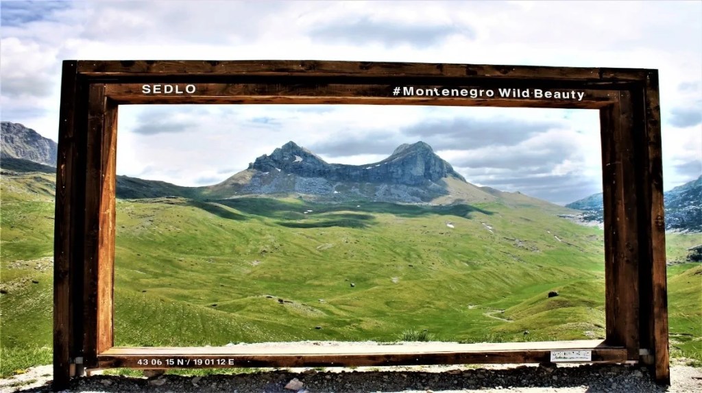
Sedlo is a mountain pass beside the road through Durmitor's open grassy slopes. Unlike the wooded lakeshore, the view here takes in broad pastures and steep rocky slopes without the shelter of trees.
Stozina and Sljeme stand out in the surrounding landscape, with the Dobri Do area on the other side of the pass. The road over Sedlo connects these different mountain landscapes. Sedlo is a pass, rather than a summit: a panorama beside the road differs from the view after climbing the neighbouring mountains.
Visiting: The official brochure warns that access to the high mountain road is seasonal. Before travelling to Sedlo, check whether the road is passable and where stopping is permitted. The brochure's description is not a road-status notice.
Durmitor Ring brochureStecci in Novakovici
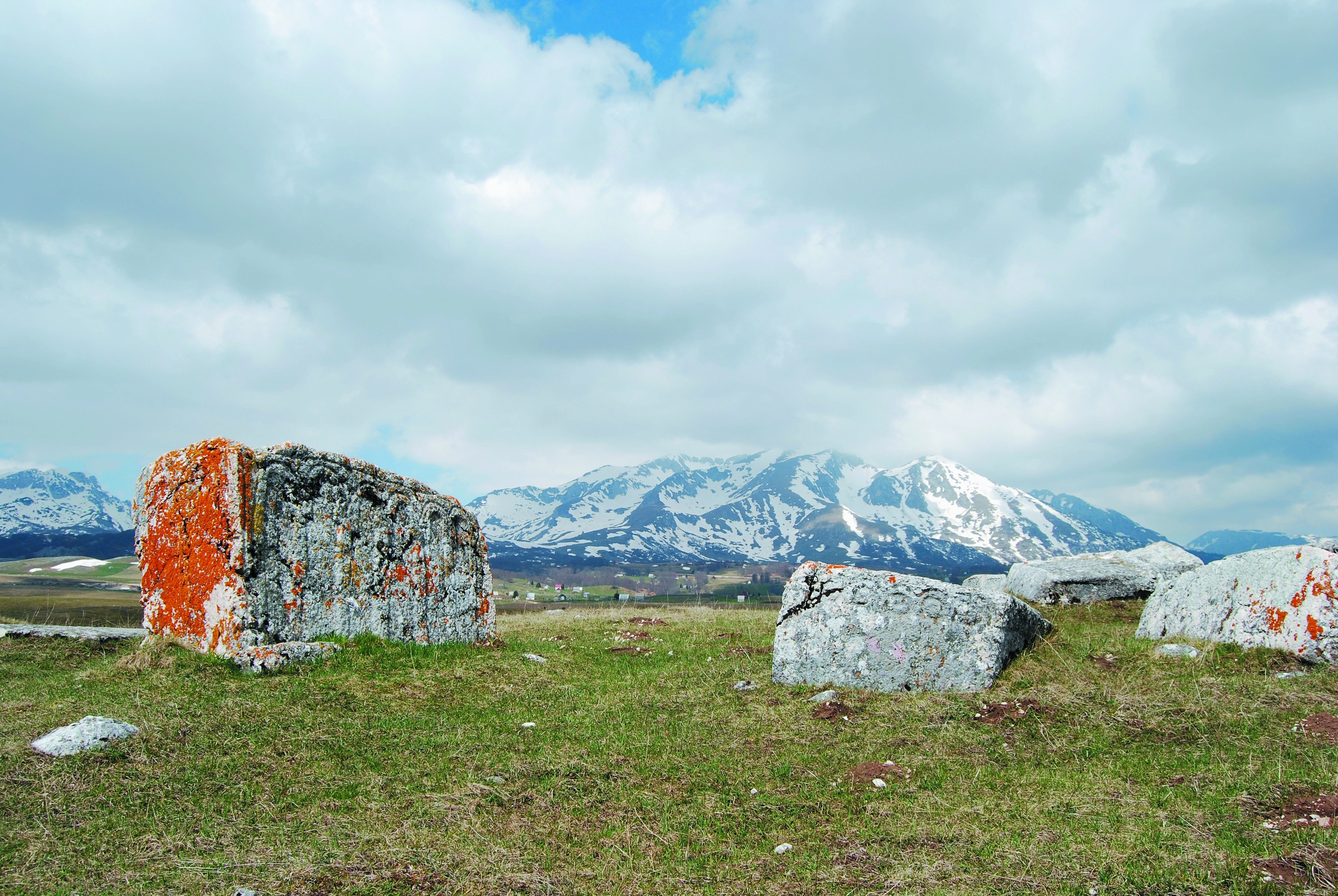
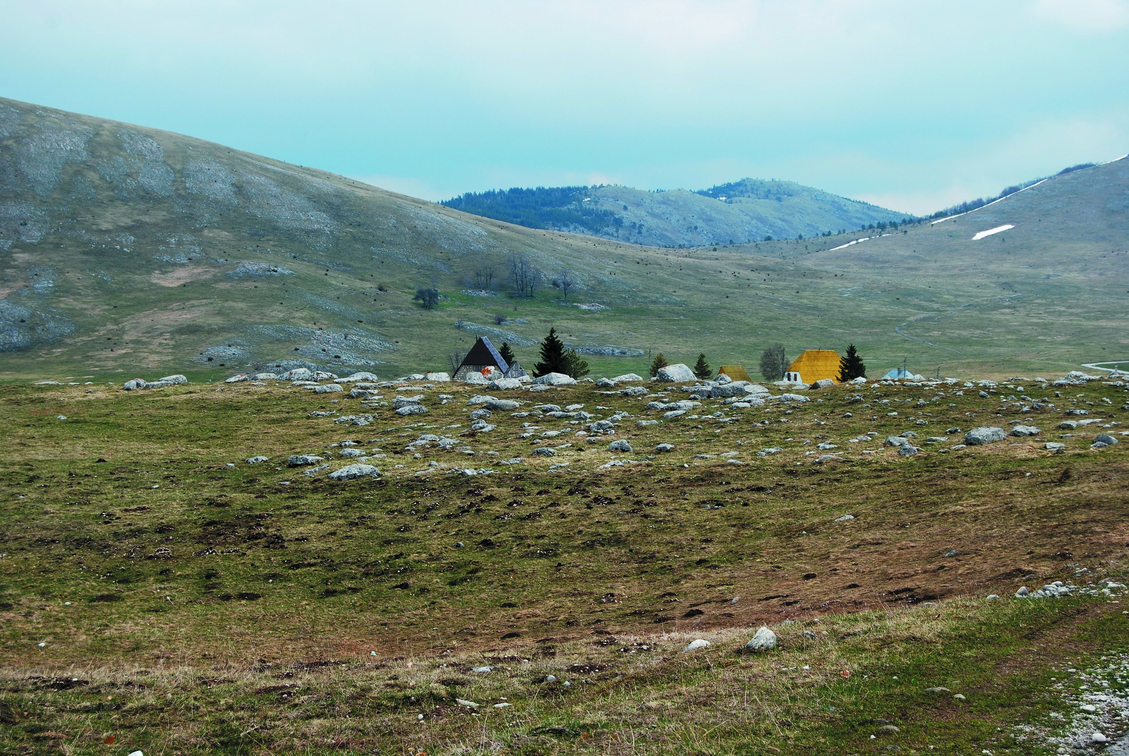
At Grcko Groblje and Bare Zugica, you can see stecci, medieval stone tombstones. They are arranged at two separate sites among meadows. Some lie as slabs, while others rise above the ground, with decorations carved into the stone surfaces.
Grcko Groblje is in Novakovici near Riblje Lake and has 49 stecci. Bare Zugica is the second burial ground, with around 300 monuments.
The monuments are associated with the fourteenth and fifteenth centuries. Both sites were inscribed on the UNESCO List in 2016 as separate components of the same medieval stecci heritage.
Visiting: Check the approach and local rules for Grcko Groblje and Bare Zugica separately. Heritage locations on a map do not confirm entrances, unrestricted access or visits without a fee.
Locations of the UNESCO sitesDjurdjevica Tara Bridge and Tara Canyon
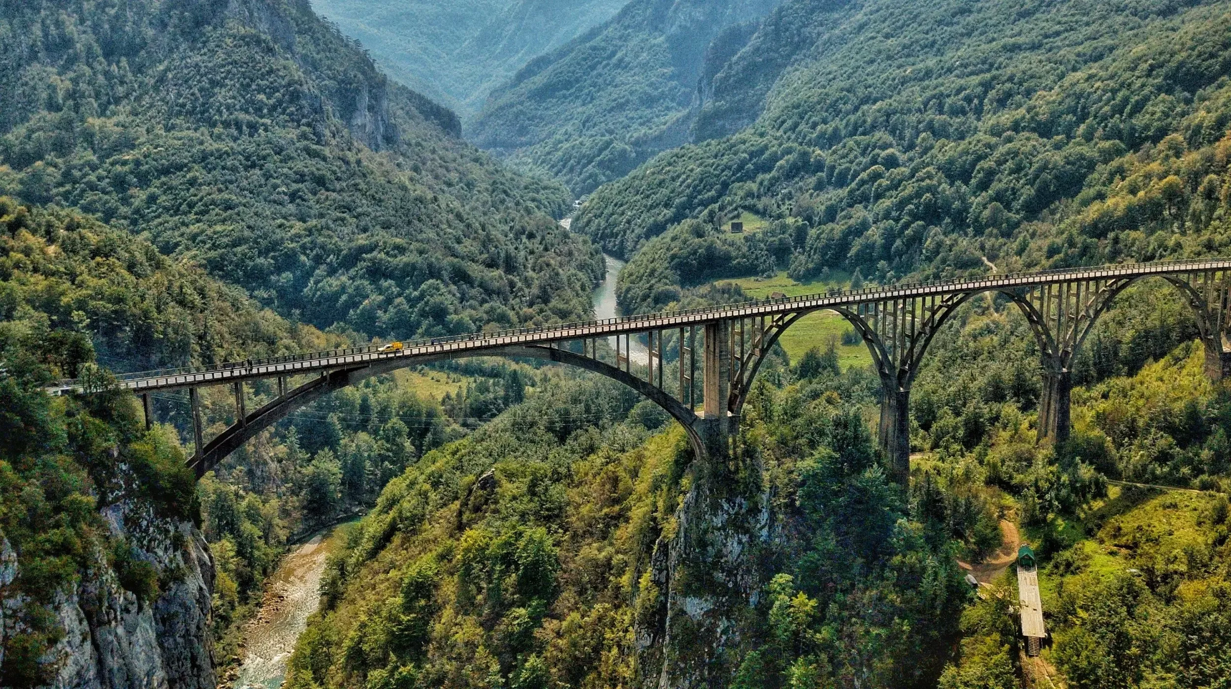
The Djurdjevica Tara Bridge consists of concrete arches above a deep, wooded canyon through which the Tara flows. The structure joins the high sides of the valley, with the river visible far below it. The difference in height between the bridge and the riverbed explains the scale of the canyon better than a view of the water alone.
The bridge has five arches and was built in 1940. From the side, you can see the large opening beneath the main arch and a series of smaller arches towards the opposite bank. This part of the canyon is viewed beside the bridge, while descending to the river and visiting other parts of the Tara are separate trips.
Visiting: For sightseeing during or after the works, confirm the permitted approach and pedestrian access. The traffic notice does not separately confirm that visitors may enter the bridge or the work zone.
Transport AdministrationIf you want to examine carved motifs up close, choose the stecci burial grounds. Choose Savin Kuk for a view taking in several lakes and peaks, once you have confirmed how you will reach the viewpoint. These are different kinds of sightseeing: an individual monument can be studied from ground level, while a panorama requires you to reach a higher vantage point.
For Sedlo, the key question is whether the mountain road is passable. For a panoramic ride towards Savin Kuk, confirm that the chairlift is operating and check the last return journey. If you want a view beside the road, choose the pass when its approach is open. If you are relying on the chairlift, check its schedule before setting out.
On the shore of Black Lake, you see the water and forest at close quarters. Beside the bridge over the Tara, the river is much farther below, at the bottom of the canyon. Choose the lake for a view from the shore, or the bridge to appreciate the depth of the river valley, from a place where sightseeing is permitted.
A name, a summit and a location are different things
Sedlo Pass is a crossing beside the mountain road. Sedlena Greda is a separate summit that may also appear under the name Sedlo on older maps. A photograph taken from the summit and the location of the pass do not describe the same visit. When looking for a panorama beside the road, check that the marker represents the pass.
Grcko Groblje near Zabljak and Grcko Groblje near Pluzine are two different sites on the UNESCO list. For the stecci described here, look for Novakovici near Riblje Lake. The same name in another location may take you to a different burial ground.
In the operator's description, the second chairlift section ends near Savina Voda. The mountain summit and the point reached by the installation are in different locations. The Savin Kuk marker on the map therefore does not show a boarding point. To arrive by chairlift, you need to establish where its lower station is and which sections are open.
What the landscape and stone reveal
Water from Black Lake drains underground towards the Tara and Piva. This connection to two rivers is not visible as a channel on the shore: an important part of the drainage takes place underground. The lake is therefore part of a wider water system, although only its basins and the surrounding forest can be seen from the shore.
A man with a sword and shield and a hunting scene have been recorded at Grcko Groblje, and a depiction of a deer at Bare Zugica. When visiting, pay attention to the decorated sides of the stecci, where carved motifs can distinguish monuments that look similar from a distance. These depictions belong to different burial grounds.
Durmitor's limestone formations are strongly folded. The name Durmitor flysch refers to layers that tectonic movement has set almost upright. Tilted and folded rocks do more than give the mountain different outlines: they also record movement in its layers.