01Montenegro’s waters and climate
Some of the country’s rivers drain into the Adriatic, while others belong to the Danube basin. The sea and changes in elevation create different climatic conditions in the south and north.
Montenegro’s waters and climate
Some of the country’s rivers drain into the Adriatic, while others belong to the Danube basin. The sea and changes in elevation create different climatic conditions in the south and north.
The sea, Lake Skadar and rivers of the Adriatic basin
The Morača flows through the central part of the country and into Lake Skadar. Its tributary, the Zeta, connects this river system with the Bjelopavlići Plain, while the Bojana carries water from the lake to the Adriatic Sea.
In the limestone hinterland, some precipitation seeps underground. The permeable bedrock explains why abundant rainfall does not always produce a well-developed network of surface streams.
Northern rivers and mountain lakes
The Tara, Piva, Lim, Ibar and Ćehotina belong to the Danube basin, whose waters ultimately reach the Black Sea. The country’s mountains therefore also divide two major drainage systems. In the north, rivers have cut deep valleys and canyons, while lakes formed by glaciers occupy higher terrain.
Plav stands beside Lake Plav. The Lim flows out of this lake, linking the lake basin with the river valley beyond. Black Lake and Biogradsko Lake are natural mountain lakes, while Lake Piva is a reservoir created by damming the river.
From coastal to mountain climates
Summers on the coast are hot and mostly dry, while winters are milder and wetter. The influence of the Adriatic reaches inland through Lake Skadar and the river valleys. As a result, the lower areas around Podgorica have different climatic conditions from the high karst basins and northern mountains.
As elevation increases, winters become colder and snowier, and summers more moderate. Mountain terrain also changes the distribution of rainfall, so proximity to the sea alone does not describe a place’s climate. Winter days on the coast can be marked by the bura, a cold northerly or northeasterly wind. The guide to when to visit covers the choice of season for a particular trip in more detail.
02History, names and the formation of the state
Duklja, Zeta and Crna Gora (Montenegro) belong to the history of territories whose extent changed over time. International recognition and the restoration of independence mark different stages in the country’s history.
History, names and the formation of the state
Duklja, Zeta and Crna Gora (Montenegro) belong to the history of territories whose extent changed over time. International recognition and the restoration of independence mark different stages in the country’s history.
Duklja, Zeta and the name Crna Gora
Duklja was a medieval state whose core territory extended from the Adriatic coast to the upper reaches of the Morača. The name Zeta also appears in sources from the 11th century and gradually replaced Duklja from the late 12th century onward. In the 13th century, Zeta included the coastal area from the Bay of Kotor toward the Bojana, as well as the inland areas around Podgorica and Lake Skadar. It was later ruled by the Balšić dynasty and, in the 15th century, by the Crnojević dynasty.
In the 14th century, the geographical name Crna Gora referred mainly to the area between Mount Lovćen and Lake Skadar. In the second half of the 15th century, when the Crnojević state’s core territory had contracted to that area, Crna Gora also became the name of the state. The name later spread beyond this smaller area as the state’s territory expanded.
Cetinje and the development of a state center
Ivan Crnojević moved his seat to Cetinje in 1482, in the karst hinterland of the coast. During Ottoman expansion, Cetinje became an important political and religious center. The later rule of the prince-bishops, who held both spiritual and secular authority, linked the country’s history to Cetinje Monastery.
Before the change in the form of government in the mid-19th century, the state included the karst area below Mount Lovćen, Bjelopavlići and the upper Morača area in the interior. Spiritual and secular authority were separated in 1852, and Montenegro became a secular principality. The development of the ruler’s court and state institutions left its mark on Cetinje’s residences, which are now part of its museum heritage.
The Treaty of Berlin and the kingdom
The Treaty of Berlin of July 13, 1878 brought international recognition of Montenegro’s independence. This was recognition of an existing state. War and boundary settlements during that period expanded its territory to include, among other areas, the Nikšić region, Zeta with Podgorica, and Bar and its surroundings. Its territory still did not encompass all of present-day Montenegro.
In 1910, on the fiftieth anniversary of his reign, Prince Nikola proclaimed Montenegro a kingdom and himself king. Representatives of European dynasties attended the proclamation celebrations in Cetinje, making the royal capital a place where the state presented itself internationally.
After the Balkan Wars of 1912 and 1913, the kingdom also included Pljevlja, Bijelo Polje and Berane, as well as the areas around Peć and Đakovica, outside present-day Montenegro.
The Yugoslav period and the restoration of independence
Montenegro ceased to exist as an independent state in 1918 and became part of the Yugoslav state. After World War II, it was one of the six republics of socialist Yugoslavia. That republic also included the Bay of Kotor, and its boundaries with the other republics became the basis of Montenegro’s present-day state borders. The administrative center moved from Cetinje to Podgorica in 1946, when Podgorica was renamed Titograd.
After socialist Yugoslavia broke up, Montenegro remained in a joint state with Serbia, first in the Federal Republic of Yugoslavia and then in the State Union of Serbia and Montenegro. Citizens supported independence in the referendum on May 21, 2006, and Parliament proclaimed it on June 3.
03Montenegro’s landscapes, settlements and built environment
The maritime settlements of the Bay of Kotor, the open coast, karst basins, central plains and different northern landscapes have distinctive terrain and different traces of building and economic activity.
Montenegro’s landscapes, settlements and built environment
The maritime settlements of the Bay of Kotor, the open coast, karst basins, central plains and different northern landscapes have distinctive terrain and different traces of building and economic activity.
The Bay of Kotor and its shoreline settlements
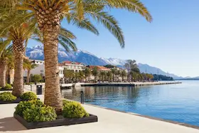
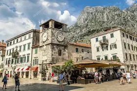
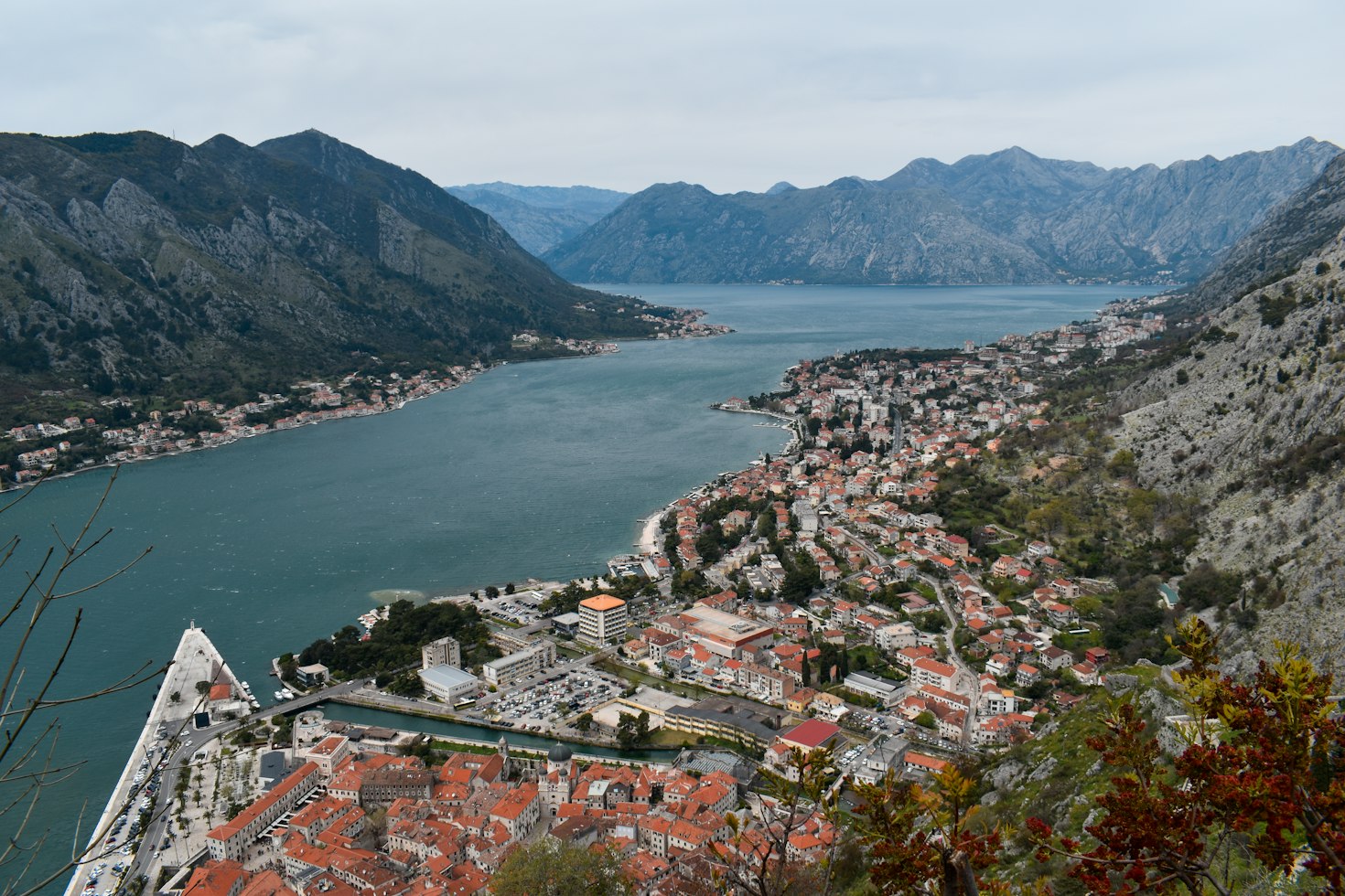
The Bay of Kotor lies in the western part of Montenegro’s coastal region. In the inner parts of the bay, the built-up shoreline is hemmed in by steep mountainsides, with terraced slopes above the settlements. The stone houses, palaces and churches of Kotor and Perast belong to a landscape in which maritime trade shaped urban development.
The Natural and Culturo-Historical Region of Kotor, inscribed on the UNESCO World Heritage List, covers the inner southeastern part of the bay. It remains an inhabited cultural landscape, with contemporary construction and tourism alongside its historic town centers.
The open coast from Budva toward Ulcinj
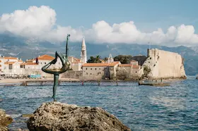
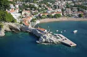
Outside the Bay of Kotor, coastal settlements face the open Adriatic. Old fortified centers and newer tourism development occupy different areas. Bečići, beside Budva, is a specific example of a former coastal dune landscape transformed by hotel development. In Stari Bar, below Mount Rumija and away from Bar’s present-day coastal center, the remains of the earlier town survive.
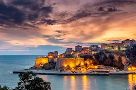
Ulcinj’s old town is clustered on a rock above the sea, with stone houses and winding streets that retain traces of Ottoman architecture. Farther south, the flatter shore of Velika Plaža extends between Port Milena and the Bojana. Fine sand deposited by the river and dunes behind the beach give it a different appearance from the stone-built old town centers.
Karst basins and the Cetinje area
Cetinje lies in a higher karst basin below Mount Lovćen, above the coastal belt. The rocky edges of the basin surround a town whose historical importance is visible in its rulers’ residences and grand state buildings. These buildings were constructed for the court and the state, giving the settlement a different appearance from the maritime towns on the coast.
King Nikola’s Palace and the Biljarda are now museum spaces. The Cetinje area also descends from the higher karst terrain toward Rijeka Crnojevića and Lake Skadar. The territory of today’s Royal Capital of Cetinje therefore extends beyond the town’s karst basin.
The central plains and Podgorica
Podgorica stands on the northern edge of the Zeta Plain, between the lake area to the south and the hilly and mountainous hinterland. The Bjelopavlići Plain continues to the northwest. In these lower, more open landscapes, riverbanks and isolated hills interrupt the flat terrain.
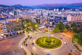
Much of Podgorica’s built environment dates from its reconstruction and expansion after World War II. New apartment blocks, administrative and educational buildings, and a transport network connecting them developed west of the Morača. Within this landscape, Podgorica now serves as the country’s administrative and university center.
Durmitor, Piva and the high plateaus
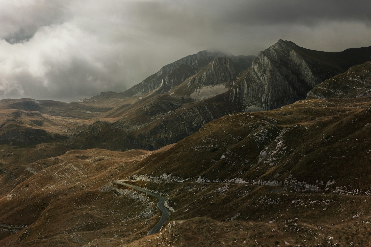
In the northwest of the country, Durmitor rises above high plateaus, forests and pastures. Glaciers shaped parts of the limestone massif and its lake basins, while rivers cut the deep canyons around it.
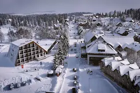
Žabljak is now a base for mountain activities associated with the protected Durmitor landscape. Farther west, Plužine is connected with Lake Piva and the surrounding canyons. The Piva reservoir introduced a large man-made body of water into the area, distinct from Durmitor’s natural lakes.
Northern valleys and eastern mountain ranges
Polimlje follows the Lim valley from Plav through Berane to Bijelo Polje. In Plav, the old settlement developed above the lakeshore and flood zone, while the town later expanded along the roads. The Redžepagić Tower originally had two stone levels, with a third, wooden level added later. Loopholes in its walls were used to defend the residential building. Today, Plav is one of the starting points for hikes in Prokletije.
Farther west, Kolašin lies in the Tara valley. Trails on Bjelasica and in Biogradska Gora can be reached from the town, and ski centers occupy nearby slopes.
The Komovi mountains have katuns, seasonal herding settlements beside mountain pastures. Their wooden huts were built close to springs, in places sheltered from the wind. They were used for herders’ summer stays and for making dairy products.
Pljevlja lies in the north of the country, in the Pljevlja basin through which the Ćehotina flows. Holy Trinity Monastery and the Husein Pasha Mosque represent the area’s Christian and Islamic heritage.
04Montenegro today
State and educational institutions, tourism, museum collections and production associated with particular areas show the different roles of the country today.
Montenegro today
State and educational institutions, tourism, museum collections and production associated with particular areas show the different roles of the country today.
State and educational roles
Podgorica is Montenegro’s capital and the seat of the Government, which conducts domestic and foreign policy and implements laws. In Cetinje, the royal capital, the president receives foreign ambassadors.
The University of Montenegro is a public university based in Podgorica. It was founded in 1974 by bringing together educational and scientific institutions. The Faculty of Dramatic Arts in Cetinje trains actors and professionals in theater, film and media. The faculty occupies the former Turkish Legation building.
Tourism and areas of production
Tourism on Montenegro’s coast creates jobs in hotels, restaurants and transport. Visitor spending also sustains purchases from domestic suppliers, so changes in the number of foreign visitors affect not only tourism businesses but also the wider network of companies supplying them.
Water from the Piva reservoir is used to generate electricity. The turbines are housed in an underground machine hall in the river canyon.
Around Podgorica, particularly on Ćemovsko Polje, irrigation enables the cultivation of vines, fruit and vegetables. In the north, some milk is processed on family farms, while some is delivered to dairies in the same or neighboring areas.
Museum collections and cultural heritage
The Art Museum of the National Museum of Montenegro, housed in the Vladin Dom building in Cetinje, holds several art collections. Its permanent display includes selected works of Montenegrin art from the late 19th century to the present day. Works by Milo Milunović, Petar Lubarda and Miodrag Dado Đurić, important figures in the development of modern Montenegrin painting, are presented separately. The display also includes a selection of Yugoslav art and icons, including Our Lady of Philermos in the Blue Chapel.
Products rooted in particular landscapes
Njeguši is an area below Mount Lovćen from which the cured ham known as Njeguški pršut takes its name. Its villages are associated with the tradition of preparing pork legs, salting them with sea salt, smoking them over beech wood, and allowing the meat to dry and mature over a long period. The geographical indication, protected at the national level in 2016, ties the name to production within Njeguši using this traditional method.
05A brief overview of landmarks
Kotor and the old coastal towns farther south, Cetinje’s historic residences, and the country’s lakes and mountains provide different geographical reference points for getting to know Montenegro.
A brief overview of landmarks
Kotor and the old coastal towns farther south, Cetinje’s historic residences, and the country’s lakes and mountains provide different geographical reference points for getting to know Montenegro.
Old towns and the royal capital
In the inner Bay of Kotor, Kotor’s old town links squares and stone passageways within its walls. Above the coastal belt is King Nikola’s Palace in Cetinje, once a ruler’s residence and now a museum.
Farther south along the coast, Stari Bar stands away from Bar’s present-day coastal center, below Mount Rumija. Ulcinj’s old town remains an inhabited center on a rock above the sea.
The lake, canyons and mountain landscapes
Lake Skadar lies south of Podgorica, while Durmitor and the Tara Canyon in the northwest form a different mountain landscape. Black Lake near Žabljak lies below the wooded and rocky slopes of the Durmitor massif. Bjelasica with Biogradska Gora and Prokletije belong to the mountain belt farther east. The guide to Montenegro’s nature goes on to explore individual landscapes and the conditions for visiting them.
How the main landscapes fit together
The Bay of Kotor lies in the western part of the coastal region, while the open coast continues toward Budva, Bar and Ulcinj.
Cetinje occupies a higher basin below Mount Lovćen, while the lower plain extends from Podgorica toward Lake Skadar.
Durmitor and Piva lie in the northwest. Farther east, the Tara and Lim valleys alternate with Bjelasica, Komovi and Prokletije.