01Kotor's location and climate
The historic centre lies between the sea, springs and a steep hillside, in a bay with drier summers and wetter winters.
Kotor's location and climate
The historic centre lies between the sea, springs and a steep hillside, in a bay with drier summers and wetter winters.
Kotor at the head of the bay beneath Sveti Ivan
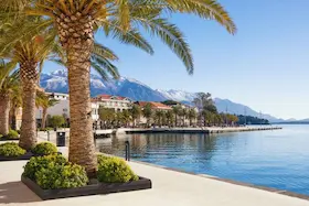
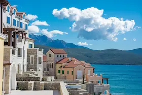
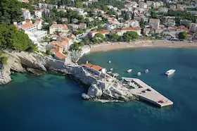
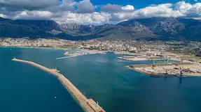
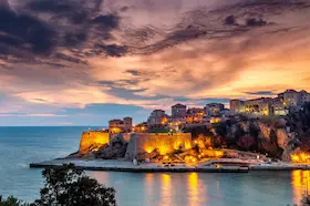
Kotor is in the south-east of the Bay of Kotor, below the slopes of Lovcen. The sea reaches far inland, and cliffs rise steeply above the town. On this narrow strip where the shore meets the mountains, the historic centre took on a roughly triangular shape, with walls following both the foot and the slope of Sveti Ivan.
The Skurda River flows along the northern side of the historic centre, while Gurdic is a karst spring on its southern side. Facing the sea are the waterfront and port, separated from the walls by the main road. The port and Old Town stand immediately beside each other, bringing maritime traffic right to the edge of the historic centre.
Warm summers and rain in Kotor's bay
Kotor follows a Mediterranean seasonal pattern, with warm, drier summers and mild, wetter winters. The nearby mountain hinterland also influences Boka's climate.
The town's connection with its karst hinterland is visible at Gurdic. After heavy rain, the spring releases large volumes of water into the bay. During dry periods, seawater enters its basin. The spring beside the walls changes in appearance with the amount of water arriving from the hinterland.
02Trade, town walls and restoration
Medieval trade, Venetian rule and restoration after the earthquake shaped the town as it is today.
Trade, town walls and restoration
Medieval trade, Venetian rule and restoration after the earthquake shaped the town as it is today.
A medieval trading and maritime town
In the Middle Ages, Kotor was an important trading and artistic centre on the Adriatic coast. Seafaring and trade were connected with crafts, and the town was home to schools of architecture and icon painting. The stone churches and palaces that survive in the historic centre reflect a town where economic and artistic activity developed together.
Kotor came under different states during its medieval history, but it also had its own municipal government, with varying degrees of autonomy.
Venetian rule and the hillside walls
Kotor came under the rule of the Republic of Venice in 1420. The Venetian period lasted for several centuries and left an important mark on the town's defensive structures and buildings. The walls, however, took shape and changed over several historical periods, from earlier fortifications to later additions.
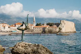
Their perimeter connects the historic centre beside the sea with Sveti Ivan fortress on the hillside. The walls follow the terrain rather than enclosing only the houses along the shore. The fortress above the town and the lower walls form a single defensive complex, which can also be seen rising up the hillside from the waterfront.
Earthquake, restoration and the UNESCO area
The 1979 earthquake severely damaged historic areas and monuments in the Kotor region. Repairs and restoration followed, with support from UNESCO. Among the damaged buildings was Grgurina Palace, home to the Maritime Museum, whose work was interrupted while the building was restored.
That same year, the Natural and Culturo-Historical Region of Kotor was inscribed on the UNESCO World Heritage List. The area extends beyond the Old Town to include historic settlements, the shore and the mountainous setting of the inner bay. Its value lies in the relationship between the natural landscape and architectural heritage, so Kotor's historic centre is considered together with the surroundings in which it developed.
03The Old Town and adjoining settlements
A compact network of squares and streets lies within the walls, while Dobrota, Muo and Skaljari have a different layout.
The Old Town and adjoining settlements
A compact network of squares and streets lies within the walls, while Dobrota, Muo and Skaljari have a different layout.
Squares and streets within the walls
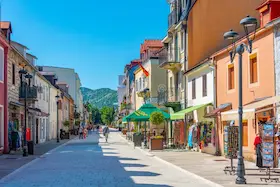
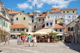
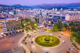
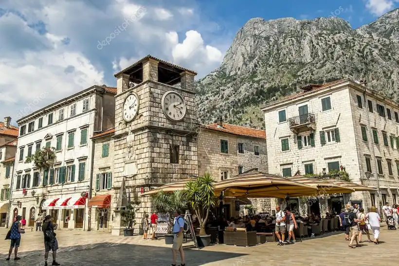
The Old Town has an irregular network of narrow streets that open onto larger and smaller squares. The Square of Arms and its Clock Tower stand beside the main Sea Gate. The pedestrian square and surrounding streets belong to the compact centre within the walls, separate from the road along the waterfront.
Stone palaces and churches were built and altered in different periods. Their facades, doorways and courtyards preserve several architectural layers within a small area. The Old Town's present appearance developed through those changes and later restoration.
Dobrota, Muo and Skaljari beyond the historic centre
Dobrota stretches along the coast beside Kotor. Its maritime past is visible in the stone palaces and homes of families connected with seafaring, with landing places beside the water. This line of waterfront buildings and settlements differs from the compact squares and streets within Kotor's walls.
Muo is a settlement beneath Vrmac, on the shore towards Prcanj. It developed as a fishing village near Kotor. Its houses and small waterfront spaces form a different type of settlement from the historic centre with its palaces and squares.
Skaljari adjoins the Old Town to the south-west. The settlement spreads across a slope between Kotor's walls, the shore and the surrounding hills. Roads leading from the Old Town along the coast towards Muo and into the hinterland meet here.
04Culture in Kotor
Maritime collections and tradition connect with contemporary art, theatre, film and town events.
Culture in Kotor
Maritime collections and tradition connect with contemporary art, theatre, film and town events.
Kotor's maritime heritage and cultural life
The Maritime Museum of Montenegro in Kotor occupies the Baroque Grgurina Palace. Its collections include ship models, paintings and objects relating to seafaring and the lives of the people of Boka. The museum developed from an earlier collection belonging to the Boka Navy brotherhood, linking it with the local community that preserved maritime heritage.
The Boka Navy is a traditional non-governmental maritime organisation. During celebrations, its members wear traditional uniforms and perform the kolo circle dance. Customs associated with St Tryphon, Kotor's patron saint, pass from generation to generation and maintain a connection between the town's maritime past, its community and its public celebrations.
The City Gallery presents contemporary art from Montenegro and other countries. It occupies the ground floor of a former convent of Franciscan nuns. The historic building now hosts exhibitions, discussions and other art activities as part of its cultural programme.
The Nikola Djurkovic Cultural Centre organises theatre performances, film screenings, literary evenings and town events. Bokeljska Noc also uses the waters of the bay in front of the Old Town for a procession of decorated boats. For specific dates and venues, see the official programme of the Nikola Djurkovic Cultural Centre.
05A brief look at Kotor's attractions
The historic centre and the shore towards Dobrota and Muo offer different ways to continue exploring Kotor.
A brief look at Kotor's attractions
The historic centre and the shore towards Dobrota and Muo offer different ways to continue exploring Kotor.
From the Old Town towards the bay
St Tryphon's Cathedral, the walls and the Maritime Museum offer different perspectives on Kotor's history. Dobrota and Muo show a different pattern of settlement along the sea. The guide to Kotor's attractions presents individual places in the town and surrounding area.
When choosing a meal, the restaurant recommendations for Kotor point you towards specific establishments. For an overnight stay, the accommodation guide compares locations in the town and nearby settlements.
The Old Town and the shore beyond the walls
Compact streets and squares between the sea, Skurda, Gurdic and the slope of Sveti Ivan.
A longer line of stone houses, palaces and landing places along the sea.
The shore towards Prcanj, with the heritage of a fishing village near Kotor.